Category:Colonial Cuba
Jump to navigation
Jump to search
English: Spanish colonial period of Cuba (1515 to 1898).
- Colonial Cuba under the Viceroyalty of New Spain to 1821, and Madrid to 1898.
Español: Historia colonial de Cuba.
Wikimedia category | |||||
| Upload media | |||||
| Instance of | |||||
|---|---|---|---|---|---|
| Category combines topics | |||||
| Category contains | |||||
 | |||||
Subcategories
This category has the following 23 subcategories, out of 23 total.
*
A
B
- Battle of Cuzco (empty)
- Battle of Guantánamo Bay (31 F)
- Battle of Las Guasimas (8 F)
C
E
- José Manuel de Ezpeleta (4 F)
G
J
- Juan de Amézqueta (7 F)
S
T
V
- Vinkhuijzen:Spain, Cuba (45 F)
Media in category "Colonial Cuba"
The following 40 files are in this category, out of 40 total.
-

-
 1591 De Bry and Le Moyne Map of Florida and Cuba - Geographicus - Florida-debry-1591.jpg 4,500 × 3,480; 6.38 MB
-
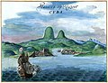
 Havana 1639.jpg 8,708 × 6,275; 4.27 MB
-
 Havana 1639b.jpg 6,471 × 4,975; 20.05 MB
-
 Van Beecq - Port St Jacques in Cuba island.jpeg 705 × 512; 176 KB
-
 1763 Terreni - Coltellini Map of Cuba and Jamaica - Geographicus - Cuba-terrini-1763.jpg 3,985 × 3,209; 2.9 MB
-
 1780 Raynal and Bonne Map of Cuba, West Indies - Geographicus - Cuba-bonne-1780.jpg 2,500 × 1,746; 1.31 MB
-

-
 1815 Thomson Map of Cuba. Bermuda ^ the Bahamas - Geographicus - Cuba-t-1816.jpg 3,500 × 2,993; 2.07 MB
-
 1855 Colton Map of Cuba, Jamaica and Porto Rico - Geographicus - Cuba-colton-1855.jpg 4,000 × 3,328; 4.1 MB
-
 Battle of Ceja del Negro.jpg 790 × 400; 68 KB
-
 Capture of Las Tunas.jpg 566 × 359; 65 KB
-
 Cartagena in the 18th century.png 413 × 281; 222 KB
-
 Plaque marking Columbus first landing in Cuba.jpg 1,085 × 725; 481 KB
-
 DeBry Map of Caribbean & Florida1594.jpg 1,619 × 1,092; 1.68 MB
-
 Farmacia La Salud de Santa Clara en la Guerra de Diez Años.jpg 600 × 309; 51 KB
-
 Independencia de Cuba, revista la flaca, 1873..jpg 667 × 396; 38 KB
-
 Indip war cuba.png 1,546 × 1,171; 2.86 MB
-
 Jacquesdesores.jpg 265 × 214; 36 KB
-
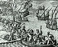
 Kuba-Indios.jpg 1,540 × 1,128; 371 KB
-
 Mapa de La Habana Vieja.JPG 2,048 × 1,536; 609 KB
-
.svg/120px-Mapa_del_Virreinato_de_la_Nueva_España_(1794).svg.png) Mapa del Virreinato de la Nueva España (1794).svg 885 × 758; 1.41 MB
Mapa del Virreinato de la Nueva España (1794).svg 885 × 758; 1.41 MB
-
.svg/120px-Mapa_del_Virreinato_de_la_Nueva_España_(1819).svg.png) Mapa del Virreinato de la Nueva España (1819).svg 885 × 664; 1.06 MB
Mapa del Virreinato de la Nueva España (1819).svg 885 × 664; 1.06 MB
-
 Maria-del-Carmen Portuondo-y-Bayeaux.jpg 529 × 809; 168 KB
-
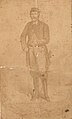 Miguel perez y cespedes or.jpg 450 × 746; 31 KB
-
 Panfilo de Narvaez.jpg 1,200 × 1,485; 591 KB
-
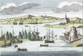
.jpg/120px-Panorama_of_La_Habana_(Amsterdam%2C_17th_century).jpg) Panorama of La Habana (Amsterdam, 17th century).jpg 5,500 × 4,595; 5.06 MB
Panorama of La Habana (Amsterdam, 17th century).jpg 5,500 × 4,595; 5.06 MB
-
.jpg/120px-Piet_Heyn_captures_ships_carrying_sugar_in_the_Bahaia_de_todos_los_Sanctos_(1627).jpg)
-
 Plaza Mayor Santa Clara Colonial.jpg 600 × 353; 70 KB
-
 Puerto del Príncipe - being sacked in 1668 - Project Gutenberg eText 19396.jpg 970 × 1,336; 635 KB
-
 Remedios en la época colonial.jpg 512 × 321; 90 KB
-
 Spanish Caribbean Islands in the American Viceroyalties 1600.png 1,600 × 953; 384 KB
-
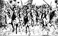
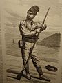
 Spanish cavalry scouting in Cuba.jpg 519 × 688; 72 KB
-
.png/120px-Viceroyalty_of_New_Spain_Location_1819_(without_Philippines).png) Viceroyalty of New Spain Location 1819 (without Philippines).png 1,157 × 857; 242 KB
Viceroyalty of New Spain Location 1819 (without Philippines).png 1,157 × 857; 242 KB
-
.png/120px-Viceroyalty_of_the_New_Spain_1800_(without_Philippines).png) Viceroyalty of the New Spain 1800 (without Philippines).png 1,600 × 1,192; 645 KB
Viceroyalty of the New Spain 1800 (without Philippines).png 1,600 × 1,192; 645 KB
-
.png/120px-Viceroyalty_of_the_New_Spain_1819_(without_Philippines).png) Viceroyalty of the New Spain 1819 (without Philippines).png 1,600 × 1,192; 668 KB
Viceroyalty of the New Spain 1819 (without Philippines).png 1,600 × 1,192; 668 KB
-
 Volontaire.jpg 768 × 1,024; 172 KB
-
 1878-Cuba-25c-PostalCard-Used.jpg 3,303 × 2,286; 1.34 MB
-
 Indicium-Cuba-1882-2c.jpg 475 × 575; 130 KB
-
 Timbre Cuba Alph13 1890.jpg 446 × 530; 65 KB


.svg)
.svg)


.jpg)
.jpg)


.png)
.png)
.png)


