Category:Maps of colonial California
Jump to navigation
Jump to search
Media in category "Maps of colonial California"
The following 12 files are in this category, out of 12 total.
-
.png/120px-Viceroyalty_of_the_New_Spain_1800_(without_Philippines).png) Viceroyalty of the New Spain 1800 (without Philippines).png 1,600 × 1,192; 645 KB
Viceroyalty of the New Spain 1800 (without Philippines).png 1,600 × 1,192; 645 KB
-
_-_Geographicus_-_Texas-pinkerton-1818.jpg/120px-1818_Pinkerton_Map_of_the_American_Southwest_(_California%2C_Louisiana%2C_New_Mexico%2C_Texas_)_-_Geographicus_-_Texas-pinkerton-1818.jpg)
-
 Nova Espanya a Mèxic.png 600 × 570; 67 KB
-
.png/120px-Viceroyalty_of_New_Spain_Location_1819_(without_Philippines).png) Viceroyalty of New Spain Location 1819 (without Philippines).png 1,157 × 857; 242 KB
Viceroyalty of New Spain Location 1819 (without Philippines).png 1,157 × 857; 242 KB
-
.png/120px-Viceroyalty_of_the_New_Spain_1819_(without_Philippines).png) Viceroyalty of the New Spain 1819 (without Philippines).png 1,600 × 1,192; 668 KB
Viceroyalty of the New Spain 1819 (without Philippines).png 1,600 × 1,192; 668 KB
-
.svg/120px-Mapa_del_Virreinato_de_la_Nueva_España_(1794).svg.png) Mapa del Virreinato de la Nueva España (1794).svg 885 × 758; 1.41 MB
Mapa del Virreinato de la Nueva España (1794).svg 885 × 758; 1.41 MB
-
.svg/120px-Mapa_del_Virreinato_de_la_Nueva_España_(1819).svg.png) Mapa del Virreinato de la Nueva España (1819).svg 885 × 664; 1.06 MB
Mapa del Virreinato de la Nueva España (1819).svg 885 × 664; 1.06 MB
-
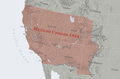 Mexican Cession.png 2,328 × 1,541; 2.81 MB
-
.png/120px-Mexico_1824_(equirectangular_projection).png) Mexico 1824 (equirectangular projection).png 1,400 × 1,047; 405 KB
Mexico 1824 (equirectangular projection).png 1,400 × 1,047; 405 KB
-
.svg/120px-Political_divisions_of_Mexico_1824_(location_map_scheme).svg.png) Political divisions of Mexico 1824 (location map scheme).svg 649 × 617; 509 KB
Political divisions of Mexico 1824 (location map scheme).svg 649 × 617; 509 KB
-
 Presidio of San Diego 1820 map.jpg 544 × 480; 64 KB
-
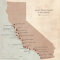 SpanishMissionsinCA.png 5,400 × 5,400; 9.23 MB
.png)
_-_Geographicus_-_Texas-pinkerton-1818.jpg)

.png)
.png)
.svg)
.svg)

.png)
.svg)

