Category:Maps of the history of the United States
Jump to navigation
Jump to search
Use the appropriate category for maps showing all or a large part of the United States. See subcategories for smaller areas:
| If the map shows | Category to use |
|---|---|
| the United States on a recently created map | Category:Maps of the United States or its subcategories |
| the United States on a map created more than 70 years ago | Category:Old maps of the United States or its subcategories |
| the history of the United States on a recently created map | Category:Maps of the history of the United States or its subcategories |
| the history of the United States on a map created more than 70 years ago | Category:Old maps of the history of the United States or its subcategories |
Wikimedia category | |||||
| Upload media | |||||
| Instance of | |||||
|---|---|---|---|---|---|
| |||||
Subcategories
This category has the following 41 subcategories, out of 41 total.
*
.
A
B
C
D
E
H
J
M
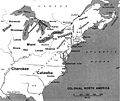
- Maps of British America (5 F)
- Maps of Cascadia (12 F)
- Maps of King Philip's War (9 F)
- Maps of New Sweden (23 F)
- Maps of the Nez Perce War (13 F)
- Maps of the Pony Express route (13 F)
- Maps of the Mexican-American War (77 F)
N
- Maps of the Northwest Indian War (18 F)
O
T
- Trail of Tears maps (5 F)
W
- Maps of the War of 1812 (54 F)
Media in category "Maps of the history of the United States"
The following 200 files are in this category, out of 482 total.
(previous page) (next page)-
 0000001c.jpg 954 × 1,230; 606 KB
-
.jpg/120px-1136_of_%27A_System_of_Modern_Geography%2C_or_the_natural_and_political_history_of_the_present_state_of_the_world%2C_etc%27_(11002030363).jpg)
-
%27_(11230089814).jpg/120px-143_of_%27A_History_of_the_United_States_for_schools_..._With_topical_analysis%2C_suggestive_questions_..._by_F._A._Hill._(With_maps.)%27_(11230089814).jpg)
-
 Coronado expedition.jpg 1,230 × 532; 130 KB
-
.jpg/120px-Aboriginal_America_east_of_the_Mississippi_(NYPL_b20643866-5452678).jpg) Aboriginal America east of the Mississippi (NYPL b20643866-5452678).jpg 5,093 × 3,816; 19.28 MB
Aboriginal America east of the Mississippi (NYPL b20643866-5452678).jpg 5,093 × 3,816; 19.28 MB
-
%27_(11130041956).jpg/92px-166_of_%27A_History_of_the_United_States_for_schools_..._With_topical_analysis%2C_suggestive_questions_..._by_F._A._Hill._(With_maps.)%27_(11130041956).jpg)
-
%27_(11225756086).jpg/82px-170_of_%27A_History_of_the_United_States_for_schools_..._With_topical_analysis%2C_suggestive_questions_..._by_F._A._Hill._(With_maps.)%27_(11225756086).jpg)
-
%27_(11225495305).jpg/80px-171_of_%27A_History_of_the_United_States_for_schools_..._With_topical_analysis%2C_suggestive_questions_..._by_F._A._Hill._(With_maps.)%27_(11225495305).jpg)
-
 Neufrankreich.svg 1,530 × 1,090; 694 KB
-
 1775 Watauga Grant.png 1,684 × 1,013; 930 KB
-
 1780-1781.jpg 593 × 631; 91 KB
-
 1789 Dist. Cts..JPG 299 × 383; 17 KB
-
 1790-1791 House of Representative Elections.png 1,043 × 894; 189 KB
-
 Mapa Terytorium Indiańskiego w XIX wieku.png 427 × 585; 64 KB
-
 Nova Espanya a Mèxic.png 600 × 570; 67 KB
-
 SantaFeTrail~1845.jpg 592 × 584; 217 KB
-
 1845 trailmap.png 993 × 589; 37 KB
-
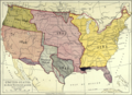
 Mexican Cession.png 2,328 × 1,541; 2.81 MB
-
 Map of the Gila Trail.pdf 1,650 × 1,275; 154 KB
-
 United States 1854-1858.png 1,000 × 677; 101 KB
-
 1859 nebraska.jpg 2,898 × 1,266; 1.33 MB
-
%27_(11304411803).jpg/79px-186_of_%27A_History_of_the_United_States_for_schools_..._With_topical_analysis%2C_suggestive_questions_..._by_F._A._Hill._(With_maps.)%27_(11304411803).jpg)
-
_p1.752_MAP_OF_THE_UNITED_STATES.jpg/96px-CRAFTS_(1868)_p1.752_MAP_OF_THE_UNITED_STATES.jpg) CRAFTS (1868) p1.752 MAP OF THE UNITED STATES.jpg 1,545 × 1,925; 2.18 MB
CRAFTS (1868) p1.752 MAP OF THE UNITED STATES.jpg 1,545 × 1,925; 2.18 MB
-
_p1.753_MAP_OF_THE_UNITED_STATES.jpg/98px-CRAFTS_(1868)_p1.753_MAP_OF_THE_UNITED_STATES.jpg) CRAFTS (1868) p1.753 MAP OF THE UNITED STATES.jpg 1,578 × 1,934; 2.49 MB
CRAFTS (1868) p1.753 MAP OF THE UNITED STATES.jpg 1,578 × 1,934; 2.49 MB
-
 Transcontinental railroad route2.png 1,000 × 619; 158 KB
-
 Transcontinental railroad route.png 1,000 × 619; 145 KB
-
 1906 Boatwright intensity.jpg 612 × 884; 539 KB
-
 1911USA.png 2,426 × 1,762; 9.59 MB
-
%27_(11229108726).jpg/77px-196_of_%27A_History_of_the_United_States_for_schools_..._With_topical_analysis%2C_suggestive_questions_..._by_F._A._Hill._(With_maps.)%27_(11229108726).jpg)
-
 1980-1990 AEBko biztanleriaren hazkunde-tasa.jpg 2,836 × 2,009; 1.28 MB
-
 1996 AEBko biztanleriaren banaketa.jpg 2,835 × 2,008; 625 KB
-
 1996 AEBko diru-sarrerak biztanleko. Batez bestekoa 100.jpg 2,836 × 2,009; 1.54 MB
-
_(16645924696).jpg/120px-1996_raptor_survey_of_the_lower_Salmon_and_Snake_Rivers_and_summary_of_raptor_surveys_conducted_1993-1996_(1997)_(16645924696).jpg)
-
.pdf/page1-92px-1996_raptor_survey_of_the_lower_Salmon_and_Snake_Rivers_and_summary_of_raptor_surveys_conducted_1993-1996_(IA_1996raptorsurvey04shep).pdf.jpg)
-
%27_(11227330723).jpg/120px-203_of_%27A_History_of_the_United_States_for_schools_..._With_topical_analysis%2C_suggestive_questions_..._by_F._A._Hill._(With_maps.)%27_(11227330723).jpg)
-
%27_(11129506455).jpg/102px-278_of_%27A_History_of_the_United_States_for_schools_..._With_topical_analysis%2C_suggestive_questions_..._by_F._A._Hill._(With_maps.)%27_(11129506455).jpg)
-
%27_(11229344986).jpg/80px-301_of_%27A_History_of_the_United_States_for_schools_..._With_topical_analysis%2C_suggestive_questions_..._by_F._A._Hill._(With_maps.)%27_(11229344986).jpg)
-
%27_(11228730053).jpg/120px-336_of_%27A_History_of_the_United_States_for_schools_..._With_topical_analysis%2C_suggestive_questions_..._by_F._A._Hill._(With_maps.)%27_(11228730053).jpg)
-
%27_(11229384824).jpg/120px-337_of_%27A_History_of_the_United_States_for_schools_..._With_topical_analysis%2C_suggestive_questions_..._by_F._A._Hill._(With_maps.)%27_(11229384824).jpg)
-
%27_(11225632313).jpg/120px-342_of_%27A_History_of_the_United_States_for_schools_..._With_topical_analysis%2C_suggestive_questions_..._by_F._A._Hill._(With_maps.)%27_(11225632313).jpg)
-
%27_(11226319273).jpg/94px-349_of_%27A_History_of_the_United_States_for_schools_..._With_topical_analysis%2C_suggestive_questions_..._by_F._A._Hill._(With_maps.)%27_(11226319273).jpg)
-
%27_(11226464386).jpg/120px-364_of_%27A_History_of_the_United_States_for_schools_..._With_topical_analysis%2C_suggestive_questions_..._by_F._A._Hill._(With_maps.)%27_(11226464386).jpg)
-
%27_(11227573695).jpg/120px-369_of_%27A_History_of_the_United_States_for_schools_..._With_topical_analysis%2C_suggestive_questions_..._by_F._A._Hill._(With_maps.)%27_(11227573695).jpg)
-
%27_(11225896704).jpg/83px-380_of_%27A_History_of_the_United_States_for_schools_..._With_topical_analysis%2C_suggestive_questions_..._by_F._A._Hill._(With_maps.)%27_(11225896704).jpg)
-
%27_(11228090054).jpg/81px-381_of_%27A_History_of_the_United_States_for_schools_..._With_topical_analysis%2C_suggestive_questions_..._by_F._A._Hill._(With_maps.)%27_(11228090054).jpg)
-
%27_(11229469446).jpg/120px-384_of_%27A_History_of_the_United_States_for_schools_..._With_topical_analysis%2C_suggestive_questions_..._by_F._A._Hill._(With_maps.)%27_(11229469446).jpg)
-
%27_(11229608144).jpg/80px-409_of_%27A_History_of_the_United_States_for_schools_..._With_topical_analysis%2C_suggestive_questions_..._by_F._A._Hill._(With_maps.)%27_(11229608144).jpg)
-
%27_(11226088713).jpg/120px-420_of_%27A_History_of_the_United_States_for_schools_..._With_topical_analysis%2C_suggestive_questions_..._by_F._A._Hill._(With_maps.)%27_(11226088713).jpg)
-
%27_(11228519116).jpg/120px-421_of_%27A_History_of_the_United_States_for_schools_..._With_topical_analysis%2C_suggestive_questions_..._by_F._A._Hill._(With_maps.)%27_(11228519116).jpg)
-
 5 tribu zibilizatuen desplazamendua.png 1,178 × 900; 1.4 MB
-
%27_(11225173935).jpg/85px-67_of_%27A_History_of_the_United_States_for_schools_..._With_topical_analysis%2C_suggestive_questions_..._by_F._A._Hill._(With_maps.)%27_(11225173935).jpg)
-
.jpg/73px-699_of_%27Outlines_of_Universal_History._Designed_as_a_text-book_and_for_private_reading%27_(11214775496).jpg)
-
%27_(11228178385).jpg/81px-75_of_%27A_History_of_the_United_States_for_schools_..._With_topical_analysis%2C_suggestive_questions_..._by_F._A._Hill._(With_maps.)%27_(11228178385).jpg)
-
%27_(11227179483).jpg/120px-88_of_%27A_History_of_the_United_States_for_schools_..._With_topical_analysis%2C_suggestive_questions_..._by_F._A._Hill._(With_maps.)%27_(11227179483).jpg)
-
.JPG/120px-thumbnail.jpg)
-

-
 Abolition of slavery in the United States SVG map.svg 942 × 595; 183 KB
-
 Adams-Onís treaty map-en.svg 626 × 478; 684 KB
-
 Adams-Onís treaty map-es.svg 626 × 478; 684 KB
-
 Adams-Onís treaty map-it.svg 626 × 478; 683 KB
-
 Adenska kultura.PNG 308 × 474; 20 KB
-
 Adquisiciones territoriales de los Estados Unidos.svg 734 × 501; 1.49 MB
-
 Agriculture US South 1860.jpg 802 × 582; 229 KB
-
 American Empire1.PNG 2,753 × 1,400; 154 KB
-
American population 1790-1860 history-punk.ogv 46 s, 1,280 × 720; 4.13 MB
-

-
_(14597439907).jpg/120px-An_historical%2C_topographical%2C_and_statistical_view_of_the_United_States_of_America_-_from_the_earliest_period_to_the_present_time_(1819)_(14597439907).jpg)
-
_(14760961336).jpg/120px-An_historical%2C_topographical%2C_and_statistical_view_of_the_United_States_of_America_-_from_the_earliest_period_to_the_present_time_(1819)_(14760961336).jpg)
-
_(14577912638).jpg/72px-An_outline_history_of_the_United_States%2C_for_public_and_other_schools%3B_(1881)_(14577912638).jpg)
-
 Anglo American War 1812 Locations map-en he.svg 1,503 × 836; 439 KB
-
 Anglo American War 1812 Locations map-en.svg 1,052 × 744; 136 KB
-
 Anglo American War 1812 Locations map-es.svg 1,494 × 830; 127 KB
-
 Anglo American War 1812 Locations map-fr.svg 1,494 × 830; 206 KB
-
 Wpdms Arizona Territory 1860 ZP.svg 254 × 154; 32 KB
-
 Barge T-36 drift and rescue - en.svg 1,770 × 925; 218 KB
-
 Barge T-36 drift and rescue - ru.svg 1,770 × 925; 232 KB
-
 Barge T-36 drift and rescue 2 - ru.svg 1,207 × 1,235; 444 KB
-
 Barren-hill-map-image.jpg 388 × 294; 31 KB
-
 Beaver wars map.jpg 871 × 736; 163 KB
-
 Beringia land bridge-noaagov.gif 700 × 458; 367 KB
-
 Blank US map 1860.svg 600 × 380; 52 KB
-
 Blank US map 1864.svg 600 × 387; 56 KB
-
 Booth escape route.png 630 × 599; 160 KB
-
 Booth escape route.svg 550 × 522; 669 KB
-
 Borders proposed by the Count of Aranda-es.svg 983 × 639; 3.21 MB
-
 Borders proposed by the Count of Aranda.svg 983 × 639; 3.39 MB
-
 Boston molasses detail map.png 874 × 742; 176 KB
-
 Braddock Expedition - ru.svg 1,367 × 1,011; 2.13 MB
-
.jpg/120px-Britisches_Nord-America_(12796647275).jpg) Britisches Nord-America (12796647275).jpg 2,470 × 2,000; 1.85 MB
Britisches Nord-America (12796647275).jpg 2,470 × 2,000; 1.85 MB
-
.jpg/120px-British_America_(13973926836).jpg) British America (13973926836).jpg 2,500 × 1,992; 2.86 MB
British America (13973926836).jpg 2,500 × 1,992; 2.86 MB
-
 British America.png 383 × 329; 11 KB
-
 British colonies 1763-76 shepherd1923.jpg 1,651 × 1,010; 625 KB
-
 British colonies 1763-76 shepherd1923.PNG 1,651 × 1,010; 3.57 MB
-
.jpg/93px-British_colonies_in_North_America_(13997468724).jpg) British colonies in North America (13997468724).jpg 1,553 × 2,000; 1.32 MB
British colonies in North America (13997468724).jpg 1,553 × 2,000; 1.32 MB
-
.jpg/120px-British_colonies%2C_in_North_America_from_the_best_authorities_(14017028493).jpg) British colonies, in North America from the best authorities (14017028493).jpg 2,445 × 2,000; 2.18 MB
British colonies, in North America from the best authorities (14017028493).jpg 2,445 × 2,000; 2.18 MB
-
.jpg/120px-British_dominions%2C_in_North_America_(13149900243).jpg) British dominions, in North America (13149900243).jpg 2,500 × 1,977; 2.15 MB
British dominions, in North America (13149900243).jpg 2,500 × 1,977; 2.15 MB
-
.jpg/120px-British_North_America_(12973239563).jpg) British North America (12973239563).jpg 2,426 × 2,000; 2.12 MB
British North America (12973239563).jpg 2,426 × 2,000; 2.12 MB
-
.jpg/120px-British_North_America_(13149900843).jpg) British North America (13149900843).jpg 2,500 × 1,985; 2.23 MB
British North America (13149900843).jpg 2,500 × 1,985; 2.23 MB
-
.jpg/120px-British_North_America_(13407301623).jpg) British North America (13407301623).jpg 2,500 × 1,974; 2 MB
British North America (13407301623).jpg 2,500 × 1,974; 2 MB
-
.jpg/120px-British_North_America_(14017027783).jpg) British North America (14017027783).jpg 2,449 × 2,000; 2.07 MB
British North America (14017027783).jpg 2,449 × 2,000; 2.07 MB
-
.jpg/120px-British_North_America_(14168300682).jpg) British North America (14168300682).jpg 2,500 × 1,983; 2.35 MB
British North America (14168300682).jpg 2,500 × 1,983; 2.35 MB
-
.jpg/120px-British_possessions_in_America_(13407180395).jpg) British possessions in America (13407180395).jpg 2,500 × 1,971; 1.67 MB
British possessions in America (13407180395).jpg 2,500 × 1,971; 1.67 MB
-
.jpg/120px-British_possessions_in_North_America_(12797057864).jpg) British possessions in North America (12797057864).jpg 2,500 × 1,831; 1.68 MB
British possessions in North America (12797057864).jpg 2,500 × 1,831; 1.68 MB
-
.jpg/120px-British_possessions_in_North_America_(14166789160).jpg) British possessions in North America (14166789160).jpg 2,500 × 1,668; 1.98 MB
British possessions in North America (14166789160).jpg 2,500 × 1,668; 1.98 MB
-
.jpg/120px-British_possessions_in_North_America_(14236338202).jpg) British possessions in North America (14236338202).jpg 2,500 × 1,579; 1.89 MB
British possessions in North America (14236338202).jpg 2,500 × 1,579; 1.89 MB
-
 Cape Cod 1620.svg 351 × 384; 24 KB
-
.jpg/120px-Carte_des_parties_nord_et_ouest_de_l%27Amérique_dressée_d%27apres_les_relations_les_plus_authentiques_(13150064744).jpg)
-
.jpg/120px-Carte_des_parties_nord_et_ouest_de_l%27Amérique_dressée_d%27apres_les_relations_les_plus_authentiques_(13903437950).jpg)
-
 Carte expedition Hernando de Soto 2-es.svg 1,052 × 744; 143 KB
-
 Carte expedition Hernando de Soto 2.svg 1,052 × 744; 180 KB
-
 Carte expedition Hernando de Soto 5.png 1,100 × 778; 279 KB
-
 Carte Lewis-Clark Expedition-es.svg 906 × 593; 763 KB
-
 Carte Lewis-Clark Expedition-fr.svg 906 × 593; 368 KB
-
 Carte Lewis-Clark Expedition.png 849 × 530; 204 KB
-
.jpg/120px-Climaxing_A_Century_Of_Progress_In_Transportation_(NBY_415278).jpg) Climaxing A Century Of Progress In Transportation (NBY 415278).jpg 811 × 506; 85 KB
Climaxing A Century Of Progress In Transportation (NBY 415278).jpg 811 × 506; 85 KB
-
 Colored map of 1790.png 800 × 564; 77 KB
-
 CSA 1861-07-02 to 1861-10-31.png 1,000 × 666; 439 KB
-
 Ctwestclaims.png 582 × 320; 37 KB
-
 Dates US Constitution ratified by the 13 States.png 685 × 857; 681 KB
-
 Delawaremap-1.png 1,169 × 1,174; 426 KB
-
 Department of the Platte.PNG 386 × 180; 5 KB
-
 DeSoto Map HRoe 2008.jpg 810 × 640; 530 KB
-
 DeSoto Map Leg 2 HRoe 2008.jpg 600 × 470; 290 KB
-
 DeSoto Map Leg 4 HRoe 2008.jpg 610 × 537; 433 KB
-
 Development of the United States, 1789 to 1959.gif 1,000 × 677; 4.75 MB
-
 Donner route map.gif 3,070 × 1,000; 900 KB
-
 Donner route map.png 3,070 × 1,000; 4.05 MB
-
 Early indian east.jpg 1,664 × 2,000; 617 KB
-
 Early indian west.jpg 1,559 × 2,000; 625 KB
-
.jpg/120px-EB9_United_States_-_historical_maps_(bottom).jpg) EB9 United States - historical maps (bottom).jpg 2,501 × 2,000; 942 KB
EB9 United States - historical maps (bottom).jpg 2,501 × 2,000; 942 KB
-
.jpg/120px-EB9_United_States_-_historical_maps_(top).jpg) EB9 United States - historical maps (top).jpg 2,488 × 1,803; 997 KB
EB9 United States - historical maps (top).jpg 2,488 × 1,803; 997 KB
-
.svg/120px-Educational_separation_in_the_US_prior_to_Brown_Map_(German-Language).svg.png) Educational separation in the US prior to Brown Map (German-Language).svg 1,000 × 700; 153 KB
Educational separation in the US prior to Brown Map (German-Language).svg 1,000 × 700; 153 KB
-
 Educational separation in the US prior to Brown Map he.svg 1,007 × 844; 192 KB
-
 Educational separation in the US prior to Brown Map.png 600 × 400; 19 KB
-
 Educational separation in the US prior to Brown Map.svg 512 × 361; 42 KB
-
 Erie Triangle.jpg 180 × 133; 7 KB
-
 Erie-triangle-context-map.png 106 × 95; 10 KB
-
 Exploration of the Upper Mississippi.png 2,700 × 4,361; 860 KB
-
 Fort Ancient Monongahela cultures HRoe 2010.jpg 700 × 496; 312 KB
-
 Wpdms fort hall.png 300 × 200; 24 KB
-
 FortLaramie.jpg 1,050 × 860; 135 KB
-
 Freeandslavestates.gif 570 × 384; 10 KB
-
 French and indian war map.svg 745 × 533; 1.38 MB
-
.png/120px-French_possessions_in_the_Americas_(1534-1803).png) French possessions in the Americas (1534-1803).png 2,000 × 2,000; 644 KB
French possessions in the Americas (1534-1803).png 2,000 × 2,000; 644 KB
-
 Frontier of NY in Revolution2.png 1,000 × 796; 780 KB
-
_(14778199564).jpg/120px-thumbnail.jpg)
-
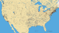
 Geographic Areas Reference Manual Figure 4-1, no. 1.png 1,215 × 737; 201 KB
-
 Geographic Areas Reference Manual Figure 4-1, no. 2.png 1,221 × 735; 254 KB
-
 Geographic Areas Reference Manual Figure 4-1, no. 3.png 1,196 × 726; 255 KB
-
 Geographic Areas Reference Manual Figure 6-2.png 547 × 631; 72 KB
-
 Geographic Areas Reference Manual Figure 6-3, no. 1.png 1,140 × 619; 286 KB
-
 Geographic Areas Reference Manual Figure 6-3, no. 2.png 1,381 × 593; 282 KB
-
 Geographic Areas Reference Manual Figure 6-4, no. 1.png 1,430 × 627; 152 KB
-
 Geographic Areas Reference Manual Figure 6-4, no. 2.png 1,310 × 629; 137 KB
-
 Geographic Areas Reference Manual Figure 6-4, no. 3.png 1,371 × 625; 146 KB
-
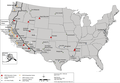
 German American internment sites during World War II.jpg 2,622 × 1,717; 1.27 MB
-
 Grant Map.jpg 1,200 × 811; 110 KB
-
 Grattan Massaker.png 1,494 × 1,035; 3.45 MB
-
 Great Valley Road Map.png 680 × 703; 635 KB
-

-
 Guèrra d'Independéncia deis Estats Units d'America - Teatre estatsunidenc.png 1,046 × 1,240; 269 KB
-
 Henry Hudson Map 26.png 824 × 709; 499 KB
-
 Hopewellska kultura.PNG 442 × 489; 29 KB
-

-
 Indiantrails1625.jpg 640 × 480; 39 KB
-
 Invasion of America Screenshot.png 1,586 × 1,238; 3.57 MB
-
 Jedediah Smith-fr.png 950 × 594; 1,016 KB
-
 JedediahSmithEnglishVersion.png 950 × 594; 940 KB
-
 JedediahSmithGermanVersion.png 950 × 594; 897 KB
-
 JedediahSmithLanguageIndependentVersion.png 950 × 594; 916 KB
-
 Kentucky County, Virginia 1776.png 638 × 300; 145 KB
-
 Kentucky County, Virginia 1780.png 638 × 300; 222 KB
-
 King's Highway.svg 251 × 509; 135 KB
-
 Kulture Graditeljev gomil.PNG 472 × 480; 36 KB
-
 La salle expedition.jpg 871 × 736; 341 KB
-
 LCASMapoftheSouthwest.jpg 700 × 535; 123 KB
-
 Carte Lewis and Clark Expedition.png 1,513 × 983; 84 KB
-
 LND interactive map.png 1,024 × 581; 517 KB
-
-
.png/120px-Map_-_Nebraska_State_Highway_System_(1955).png) Map - Nebraska State Highway System (1955).png 5,357 × 2,797; 25.54 MB
Map - Nebraska State Highway System (1955).png 5,357 × 2,797; 25.54 MB
-
 Map of CSA with CSA and Union state names.svg 959 × 593; 332 KB
-
 Map of CSA with state names.svg 959 × 593; 333 KB
-
_within_USA.png/120px-Map_of_New_Afrika_(according_to_information)_within_USA.png) Map of New Afrika (according to information) within USA.png 1,555 × 982; 428 KB
Map of New Afrika (according to information) within USA.png 1,555 × 982; 428 KB
-
 Map of Ohio, Monongalia, & Yohogania Counties.jpg 1,002 × 1,160; 199 KB
-
.svg/120px-Map_of_states_and_counties_affected_by_the_Dust_Bowl%2C_sourced_from_US_federal_government_dept._(NRCS_SSRA-RAD).svg.png)
-

-

-
.jpg/120px-Map_of_the_Rancho_San_Pedro_finally_confirmed_to_Manuel_Dominguez_et_al.%2C_December_1859_(sc_hwmc000790001).jpg)
-
 Map of World War II Japanese American internment camps.png 896 × 744; 105 KB
-
 Map The Coronado Expedition 1541 Routes in a zone of uncertainty.png 1,974 × 1,048; 1.5 MB
-
.svg/120px-Mapa_de_estados_y_condados_afectados_por_el_Dust_Bowl%2C_hecho_por_el_gobierno_federal_de_los_EEUU_(NRCS_SSRA-RAD).svg.png)
-
.svg/120px-Mapa_del_Virreinato_de_la_Nueva_España_(1794).svg.png) Mapa del Virreinato de la Nueva España (1794).svg 885 × 758; 1.41 MB
Mapa del Virreinato de la Nueva España (1794).svg 885 × 758; 1.41 MB
-
.svg/120px-Mapa_del_Virreinato_de_la_Nueva_España_(1819).svg.png) Mapa del Virreinato de la Nueva España (1819).svg 885 × 664; 1.06 MB
Mapa del Virreinato de la Nueva España (1819).svg 885 × 664; 1.06 MB
-
 Maritime Fur Trade-NorthWestCoast.png 1,173 × 819; 208 KB
-
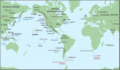 Maritime Fur Trade-WorldContext.png 1,378 × 805; 232 KB
-
 Masscolony.png 1,239 × 1,000; 618 KB
-
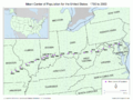 Mean ctr pop US 1790-2000.png 1,431 × 1,074; 275 KB
-
 Mean ctr pop USA 1790-2010.png 1,431 × 1,074; 778 KB
-
-en.svg/120px-Mexican–American_War_(without_Scott%27s_Campaign)-en.svg.png) Mexican–American War (without Scott's Campaign)-en.svg 1,433 × 1,230; 610 KB
Mexican–American War (without Scott's Campaign)-en.svg 1,433 × 1,230; 610 KB
-
-ru.svg/120px-Mexican–American_War(without_Scott%27s_Campaign)-ru.svg.png) Mexican–American War(without Scott's Campaign)-ru.svg 1,430 × 1,230; 608 KB
Mexican–American War(without Scott's Campaign)-ru.svg 1,430 × 1,230; 608 KB

.jpg)
%27_(11230089814).jpg)

.jpg)
%27_(11130041956).jpg)
%27_(11225756086).jpg)
%27_(11225495305).jpg)


%27_(11304411803).jpg)
_p1.752_MAP_OF_THE_UNITED_STATES.jpg)
_p1.753_MAP_OF_THE_UNITED_STATES.jpg)


%27_(11229108726).jpg)


_(16645924696).jpg)
%27_(11227330723).jpg)
%27_(11129506455).jpg)
%27_(11229344986).jpg)
%27_(11228730053).jpg)
%27_(11229384824).jpg)
%27_(11225632313).jpg)
%27_(11226319273).jpg)
%27_(11226464386).jpg)
%27_(11227573695).jpg)
%27_(11225896704).jpg)
%27_(11228090054).jpg)
%27_(11229469446).jpg)
%27_(11229608144).jpg)
%27_(11226088713).jpg)
%27_(11228519116).jpg)

%27_(11225173935).jpg)
.jpg)
%27_(11228178385).jpg)
%27_(11227179483).jpg)
.JPG)


_(14597439907).jpg)
_(14760961336).jpg)
_(14577912638).jpg)


.jpg)
.jpg)


.jpg)
.jpg)
.jpg)
.jpg)
.jpg)
.jpg)
.jpg)
.jpg)
.jpg)
.jpg)
.jpg)
.jpg)

.jpg)
.jpg)


.jpg)
.jpg)
.svg)


.png)

_(14778199564).jpg)


.png)


_within_USA.png)

.svg)


.jpg)


.svg)
.svg)
.svg)


-en.svg)
-ru.svg)
.jpg)