Category:Maps of the Viceroyalty of New Spain
Jump to navigation
Jump to search
English: Maps of the Spanish colonial Viceroyalty of New Spain (Virreinato de Nueva España) of 1535—1821 in North America.
Subcategories
This category has the following 10 subcategories, out of 10 total.
1
- 1800s maps of Mexico (15 F)
F
- Maps of Spanish Florida (20 F)
L
- Maps of Spanish Louisiana (11 F)
O
T
- Maps of Spanish Texas (17 F)
Media in category "Maps of the Viceroyalty of New Spain"
The following 65 files are in this category, out of 65 total.
-
.svg/120px-New_Spain_(orthographic_projection).svg.png) New Spain (orthographic projection).svg 550 × 550; 770 KB
New Spain (orthographic projection).svg 550 × 550; 770 KB
-
.png/120px-Viceroyalty_of_the_New_Spain_1800_(without_Philippines).png) Viceroyalty of the New Spain 1800 (without Philippines).png 1,600 × 1,192; 645 KB
Viceroyalty of the New Spain 1800 (without Philippines).png 1,600 × 1,192; 645 KB
-
.svg/120px-Viceroyalty_of_New_Spain_(orthographic_projection).svg.png) Viceroyalty of New Spain (orthographic projection).svg 550 × 550; 359 KB
Viceroyalty of New Spain (orthographic projection).svg 550 × 550; 359 KB
-
 Viceroyalty of New Spain-Territories.svg 863 × 444; 1.23 MB
-
 Map of the Viceroyalty of New Spain.svg 3,121 × 1,586; 1.67 MB
-
 Coronado expedition.jpg 1,230 × 532; 130 KB
-
 Andres Urdaneta Tornaviaje.jpg 1,590 × 1,306; 1.54 MB
-
 Spanish Caribbean Islands in the American Viceroyalties 1600.png 1,600 × 953; 384 KB
-
 16th century Portuguese Spanish trade routes.png 2,835 × 1,188; 2 MB
-
 16th century Spanish trade routes.png 2,835 × 1,188; 775 KB
-

-
 Nova Espanya a Mèxic.png 600 × 570; 67 KB
-
 Adams onis map.png 800 × 654; 226 KB
-
 California missions. LOC 2008627969.jpg 5,431 × 7,560; 7.15 MB
-
 California missions. LOC 2008627969.tif 5,431 × 7,560; 117.47 MB
-
 CaminoRealAdentro.png 698 × 682; 374 KB
-
 Chichimeca Nations.png 959 × 645; 96 KB
-
 Chichimecas - esp.png 713 × 961; 169 KB
-
 Chichimecas.png 713 × 961; 165 KB
-
 ChichimecNations.png 1,073 × 723; 139 KB
-
 El Camino Real de los Tejas National Historic Trail.png 630 × 606; 222 KB
-
 Flujo minero en Nueva España.jpg 2,131 × 1,350; 181 KB
-
 Intendencia de yucatán.PNG 237 × 375; 28 KB
-
 Itinerario legazpi.jpg 328 × 716; 70 KB
-
 La nueva españa 1.PNG 805 × 628; 25 KB
-
.jpeg/87px-Map_of_America-Ribero_(1529).jpeg) Map of America-Ribero (1529).jpeg 5,800 × 7,978; 3.58 MB
Map of America-Ribero (1529).jpeg 5,800 × 7,978; 3.58 MB
-
.svg/120px-Mapa_del_Virreinato_de_la_Nueva_España_(1794).svg.png) Mapa del Virreinato de la Nueva España (1794).svg 885 × 758; 1.41 MB
Mapa del Virreinato de la Nueva España (1794).svg 885 × 758; 1.41 MB
-
.svg/120px-Mapa_del_Virreinato_de_la_Nueva_España_(1819).svg.png) Mapa del Virreinato de la Nueva España (1819).svg 885 × 664; 1.06 MB
Mapa del Virreinato de la Nueva España (1819).svg 885 × 664; 1.06 MB
-
 Mapa Virreinato Nueva España.png 939 × 720; 72 KB
-
 Neufrankreich.svg 1,530 × 1,090; 694 KB
-
 New Spain.png 1,357 × 628; 19 KB
-
 Non-Native American Nations Control over N America 1792.png 800 × 895; 160 KB
-
 NovohispanMap.jpg 1,513 × 1,397; 320 KB
-
 Nueva España 1795.png 4,000 × 2,169; 486 KB
-
 Nueva España+.png 963 × 449; 78 KB
-
 Nueva España.JPG 3,072 × 2,304; 1.73 MB
-
 NuevaEspaña-Louisiana.jpg 852 × 433; 113 KB
-
 NuevaEspaña-Louisiana.svg 852 × 433; 100 KB
-
 NUEVAGALICIA NUEVA ESPAÑA 1548.svg 1,000 × 680; 178 KB
-
 Nuevo reyno de la Nueva Navara con sus confinantes otros reynos.jpg 1,385 × 1,054; 449 KB
-
 Imperio español en Asia y Oceanía.png 300 × 323; 25 KB
-
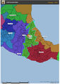
 Partidos Intendencia-Provincia San Salvador.svg 1,170 × 890; 32 KB
-
 Partidos-Tenencias 1658 - 1672 Alcaldía Mayor San Salvador.svg 1,963 × 1,097; 35 KB
-
 Partidos-Tenencias 1672 - 1725 Alcaldía Mayor de San Salvador.svg 1,747 × 1,017; 35 KB
-
 Partidos-Tenencias 1725 - 1785 Alcaldía Mayor San Salvador.svg 1,458 × 1,026; 34 KB
-
 Partidos-Tenencias principios siglo XVII - 1658 Alcaldía Mayor San Salvador.svg 1,973 × 1,097; 33 KB
-
 Political Evolution of Central America and the Caribbean 1700 and on.gif 850 × 638; 348 KB
-
_y_Provincia_de_San_Miguel_1534_-_1535.svg/120px-Provincia_de_San_Salvador_(poblaciones_pipiles_y_chontales)_y_Provincia_de_San_Miguel_1534_-_1535.svg.png)
-
_1529_-_1530.svg/120px-Provincia_de_San_Salvador_(poblaciónes_Pipiles_y_Chontales)_1529_-_1530.svg.png) Provincia de San Salvador (poblaciónes Pipiles y Chontales) 1529 - 1530.svg 1,263 × 1,130; 17 KB
Provincia de San Salvador (poblaciónes Pipiles y Chontales) 1529 - 1530.svg 1,263 × 1,130; 17 KB
-
_y_Provincia_de_San_Miguel_1530_-_1534.svg/120px-Provincia_de_San_Salvador_(poblaciónes_Pipiles_y_Chontales)_y_Provincia_de_San_Miguel_1530_-_1534.svg.png)
-
 Provincia de San Salvador y Provincia de San Miguel 1535 - 1580.svg 1,271 × 917; 16 KB
-
 Provincias 1580 - principios siglo XVII Alcaldía Mayor San Salvador.svg 1,822 × 1,026; 22 KB
-
 Provincias 1658 - 1672 Alcaldía Mayor San Salvador.svg 1,735 × 1,025; 24 KB
-
 Provincias 1672 - 1725 Alcaldía Mayor San Salvador.svg 1,468 × 905; 18 KB
-
 Provincias 1725 - 1785 Alcaldía Mayor San Salvador.svg 1,150 × 787; 19 KB
-
 Provincias principios siglo XVII - 1658 Alcaldía Mayor San Salvador.svg 1,746 × 1,021; 19 KB
-
 Puebla, 1787.png 1,241 × 1,755; 213 KB
-
 Puebla1793.png 1,241 × 1,755; 215 KB
-
 Spanish Missions in Texas.JPG 552 × 487; 27 KB
-
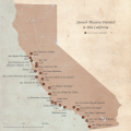 SpanishMissionsinCA.png 5,400 × 5,400; 9.23 MB
-
 Tenencias-Distritos Intendencia-Provincia San Salvador.svg 1,663 × 1,089; 50 KB
-
 Territories of the Viceroyalty of New Spain.png 1,357 × 628; 42 KB
-
.png/120px-Viceroyalty_of_New_Spain_Location_1819_(without_Philippines).png) Viceroyalty of New Spain Location 1819 (without Philippines).png 1,157 × 857; 242 KB
Viceroyalty of New Spain Location 1819 (without Philippines).png 1,157 × 857; 242 KB
-
.png/120px-Viceroyalty_of_the_New_Spain_1819_(without_Philippines).png) Viceroyalty of the New Spain 1819 (without Philippines).png 1,600 × 1,192; 668 KB
Viceroyalty of the New Spain 1819 (without Philippines).png 1,600 × 1,192; 668 KB
-
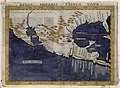 Ruscelli Nueva Hispania Tabula Nova 1574 UTA.jpg 6,497 × 4,779; 9.78 MB
.svg)
.png)
.svg)


.jpeg)
.svg)
.svg)


_y_Provincia_de_San_Miguel_1534_-_1535.svg)
_1529_-_1530.svg)
_y_Provincia_de_San_Miguel_1530_-_1534.svg)


.png)
.png)

Categories:
- Viceroyalty of New Spain
- Maps of the Spanish Americas
- Maps of the history of North America
- Maps of the history of Mexico
- Maps of the history of the Caribbean
- Maps of the history of the United States
- Maps of the history of Guatemala
- Maps of the history of Honduras
- Maps of the history of El Salvador
- Maps of the history of Nicaragua
- Maps of the history of Costa Rica